File:Solar Irradiation ET.jpg
From energypedia
Revision as of 12:26, 11 July 2011 by ***** (***** | *****) (Solar irradiation in Ethiopia (in kWh/m2/day). Source: SWERA 2005. Solar, annual average latitude tilt map at 40km resolution for Africa from NREL http://swera.unep.net/typo3conf/ext/metadata_tool/archive/download/africatilt_218.pdf [[Category:Ethiopia)
No higher resolution available.
Solar_Irradiation_ET.jpg (531 × 440 pixels, file size: 49 KB, MIME type: image/jpeg)
Summary
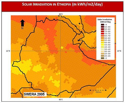
Solar irradiation in Ethiopia (in kWh/m2/day). Source: SWERA 2005. Solar, annual average latitude tilt map at 40km resolution for Africa from NREL http://swera.unep.net/typo3conf/ext/metadata_tool/archive/download/africatilt_218.pdf
Licensing
| External file. Open Content. | This file is from an external source. It has been published under an open content license. Details about the license can be found in the file description. Please report copyright infringements to the energypedia team. |
|---|
File history
Click on a date/time to view the file as it appeared at that time.
| Date/Time | Thumbnail | Dimensions | User | Comment | |
|---|---|---|---|---|---|
| current | 11:27, 22 August 2011 | | 531 × 440 (49 KB) | ***** (***** | *****) | |
| 12:26, 11 July 2011 | 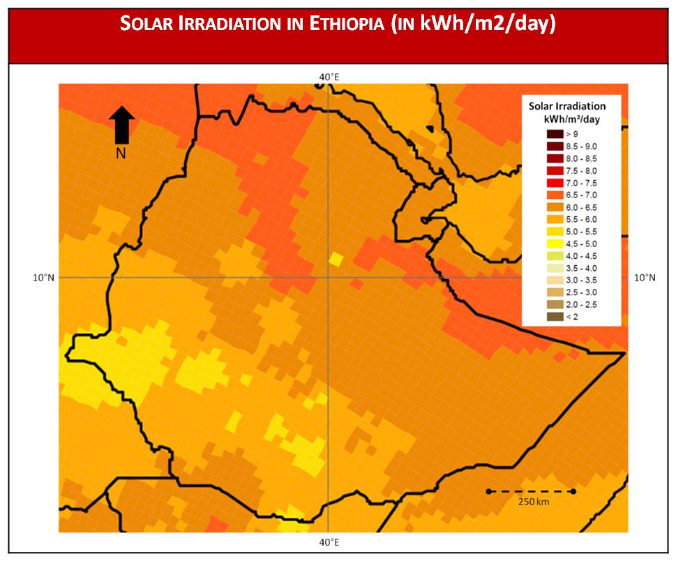 | 969 × 804 (89 KB) | ***** (***** | *****) | Solar irradiation in Ethiopia (in kWh/m2/day). Source: SWERA 2005. Solar, annual average latitude tilt map at 40km resolution for Africa from NREL http://swera.unep.net/typo3conf/ext/metadata_tool/archive/download/africatilt_218.pdf [[Category:Ethiopia |
You cannot overwrite this file.
File usage
The following page uses this file:


