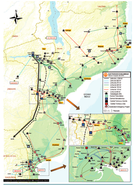
File:Grid Map of Mozambique.png
From energypedia
Revision as of 13:44, 12 September 2021 by ***** (***** | *****)

Size of this preview: 432 × 600 pixels. Other resolutions: 173 × 240 pixels | 929 × 1,290 pixels.
Original file (929 × 1,290 pixels, file size: 1.72 MB, MIME type: image/png)
Licensing
| This file is licensed under the Creative CommonsAttribution-NonCommercial 4.0 International license. | ||
|
File history
Click on a date/time to view the file as it appeared at that time.
| Date/Time | Thumbnail | Dimensions | User | Comment | |
|---|---|---|---|---|---|
| current | 13:44, 12 September 2021 | | 929 × 1,290 (1.72 MB) | ***** (***** | *****) |
You cannot overwrite this file.
File usage
The following 2 pages use this file:


