File:Map of Brasil (terrain).jpg
From energypedia
Revision as of 16:32, 26 August 2011 by ***** (***** | *****)
No higher resolution available.
Map_of_Brasil_(terrain).jpg (275 × 300 pixels, file size: 90 KB, MIME type: image/jpeg)
Summary
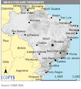
This small map Brasil has been prepared by ECOFYS Germany GmbH based on data from the Consultive Group of International Agricultural Research (CGIAR) for the study of the German International Cooperation (GIZ 2009) Energy-policy Framework Conditions for Electricity Markets and Renewable Energies - 16 countries analysesSmall map of brasil (terrain)
Licensing
| File from GIZ Source. | This file has been produced specifically for GIZ, but someone other than the author has uploaded the file. Therefore the copyright provisions of the original source apply to this file. In case that the original source and its copyright provisions are unclear, this file can be only used on energypedia within the context of the German Copyright Law. Please report copyright infringements to the energypedia staff so that it can delete the appropriate files. |
|---|
File history
Click on a date/time to view the file as it appeared at that time.
| Date/Time | Thumbnail | Dimensions | User | Comment | |
|---|---|---|---|---|---|
| current | 17:00, 28 July 2011 | | 275 × 300 (90 KB) | ***** (***** | *****) | Small map of brasil (terrain) Category:Brazil Category:Wind |
You cannot overwrite this file.
File usage
The following page uses this file:


.jpg&diff=prev&oldid=37886)
.jpg&direction=prev&oldid=37886)
.jpg&oldid=37886)
.jpg)
.jpg&action=edit&redlink=1)
.jpg&action=edit)
.jpg&action=history)
.jpg)
.jpg)
.jpg&oldid=37886)
.jpg&action=info)
.jpg)