Knowledge fuels change
For over a decade, Energypedia has shared free, reliable energy expertise with the world.
We’re now facing a serious funding gap.
Help keep this platform alive — your donation, big or small, truly matters!
Thank you for your support
Difference between revisions of "Suriname Energy Situation"
***** (***** | *****) |
***** (***** | *****) |
||
| Line 27: | Line 27: | ||
= Energy Situation = | = Energy Situation = | ||
| + | |||
| + | == Overview == | ||
| + | |||
| + | == Energy Access == | ||
| + | |||
| + | == Production == | ||
| + | |||
| + | == Installed Capacity == | ||
| + | |||
| + | == Consumption == | ||
| + | |||
| + | == Import and Export == | ||
| + | |||
| + | == Electricity == | ||
| + | |||
| + | == Energy Security == | ||
= Renewable Energy = | = Renewable Energy = | ||
Revision as of 14:57, 4 March 2019
Capital:
Paramaribo
Region:
Coordinates:
5.8333° N, 55.1667° W
Total Area (km²): It includes a country's total area, including areas under inland bodies of water and some coastal waterways.
XML error: Mismatched tag at line 6.
Population: It is based on the de facto definition of population, which counts all residents regardless of legal status or citizenship--except for refugees not permanently settled in the country of asylum, who are generally considered part of the population of their country of origin.
XML error: Mismatched tag at line 6. ()
Rural Population (% of total population): It refers to people living in rural areas as defined by national statistical offices. It is calculated as the difference between total population and urban population.
XML error: Mismatched tag at line 6. ()
GDP (current US$): It is the sum of gross value added by all resident producers in the economy plus any product taxes and minus any subsidies not included in the value of the products. It is calculated without making deductions for depreciation of fabricated assets or for depletion and degradation of natural resources.
XML error: Mismatched tag at line 6.2 ()
GDP Per Capita (current US$): It is gross domestic product divided by midyear population
XML error: Mismatched tag at line 6. ()
Access to Electricity (% of population): It is the percentage of population with access to electricity.
XML error: Mismatched tag at line 6.no data
Energy Imports Net (% of energy use): It is estimated as energy use less production, both measured in oil equivalents. A negative value indicates that the country is a net exporter. Energy use refers to use of primary energy before transformation to other end-use fuels, which is equal to indigenous production plus imports and stock changes, minus exports and fuels supplied to ships and aircraft engaged in international transport.
XML error: Mismatched tag at line 6.no data
Fossil Fuel Energy Consumption (% of total): It comprises coal, oil, petroleum, and natural gas products.
XML error: Mismatched tag at line 6.no data
Introduction
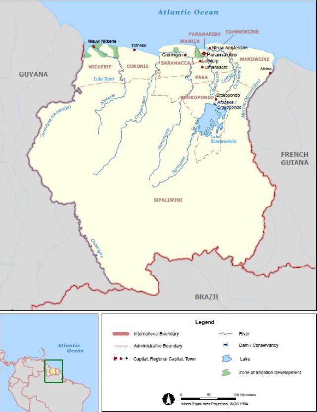
Suriname, also known as Republic of Suriname, is a country located on the north-eastern Atlantic coast of South America[1]. The country’s total area is below 165,000 Km2, which makes it the smallest country in South America[1]. 80% of the country’s area is covered with tropical rain forests, with only 1.5 million ha are considered suitable for agriculture[2]. The majority of the country’s inhabitants are located in the country’s north coast, particularly within and around the capital ‘Paramaribo’[1].
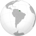
Suriname is bordered by French Guiana to the east, Guyana to the west, Brazil to the south & the Atlantic Ocean to the north[1][2]. The region in the north is mostly lowland coastal area, where most of the land has been cultivated, while the southern part consists of tropical rainforest and randomly distributed inhabited savanna along the county’s borders with Brazil[1].
The country’s climate is mostly hot and humid through the year; equatorial in coastal areas, tropical monsoon further inland and tropical savannah in the south-western portions of the country[1]. Suriname has two wet seasons; the 1st and the main one is from April to July, and the 2nd and shorter one is in the period December-January[1]. The northern populated area has four different seasons: a minor rainy season from early December to early February, a minor dry season from early February to late April, a major rainy season from late April to mid-August and a major dry season from mid-August to early December [2].
Suriname has a variety of natural resources, but the national economy is dominated by certain mining activities and agricultural products [1][3][4]. The primary mining products are: oil, bauxite and gold, while in the agriculture sector, rice and bananas are the dominant products[1][3][4]. Suriname is highly energy-independent due to the combination of the mining of fossil fuels and the significant wealth of hydropower, thus, energy-wise, it is a very self-sufficient country[3].
After Trinidad & Tobago, and Cuba, Suriname comes in as the 3rd largest oil producer in the Caribbean[3]
Energy Situation
Overview
Energy Access
Production
Installed Capacity
Consumption
Import and Export
Electricity
Energy Security
Renewable Energy
Fossil Fuels
Key Problems of the Energy Sector
Policy Framework, Laws and Regulations
Institutional Set up in the Energy Sector
Other Key Actors / Activities of Donors, Implementing Agencies, Civil Society Organisations
Further Information
References
- ↑ 1.0 1.1 1.2 1.3 1.4 1.5 1.6 1.7 1.8 World Meteorological Organization (WMO) & Caribbean Institute for Meteorology and Hydrology (CIMH). (2018). Country Profile: Suriname. Retrieved from: http://rcc.cimh.edu.bb/files/2018/06/Country-Profile-Suriname.pdf
- ↑ 2.0 2.1 2.2 Food and Agriculture Organization of the United Nations (FAO). (2015). Country Profile – Suriname. Retrieved from: http://www.fao.org/3/ca0427en/CA0427EN.pdf
- ↑ 3.0 3.1 3.2 3.3 Ramón, E. & Humpert, M. (2014). Energy Matrix Country Briefings: Antigua & Barbuda, Bahamas, Barbados, Dominica, Grenada, Guyana, Haiti, Jamaica, St. Kitts & Nevis, St. Lucia, St. Vincent and the Grenadines, Suriname, and Trinidad & Tobago. Retrieved from: https://publications.iadb.org/en/publication/11241/energy-matrix-country-briefings-antigua-barbuda-bahamas-barbados-dominica-grenada
- ↑ 4.0 4.1 Roy, D. Bizikova, L. Borden, C. Swanson, D. & Huppé, G.A. (2015). Water-Energy-Food Security and Mining in Suriname. Retrieved from: https://www.iisd.org/sites/default/files/publications/water-energy-food-security-mining-suriname-project-overview.pdf


